

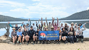
OTP Sample Adventure Trip Itinerary
Every Ocean To Peak Adventures trip is built around thoughtful planning, real-world experience, and attention to detail. Each Adventure Trip follows a comprehensive OTP itinerary designed by experienced OTP leaders, outlining daily schedules, routes, mileage, locations, GPS coordinates, activities, and logistics. This structured approach ensures every trip is well organized, immersive, and focused on the experience itself—allowing participants to explore confidently while the details are handled in advance.
Itinerary
Sample Itinerary Adventure Trip
May 15 - 18, 2026
GPS COORDINATES
All of our trip locations are listed in this itinerary. When you’re on the trip you'll copy the GPS coordinates (numbers) that are below each day and paste them into your driving navigation app.
Example of the numbers (939.9094800, -11.6418800)
Before coming on the trip you'll need to download an offline map of the area so the GPS coordinates will work when there isn’t cell service.
Day 1 (Friday, Aug 15)
1:00pm Basecamp opens
Set up your camp spots, get familiar with basecamp, relax, and meet OTP people
3:45pm Drive from basecamp to Visitor Center (3 min drive from basecamp)
4:00pm Meet at the Visitor Center and begin walking the Lake Trail (2.6 mile hike)
5:30pm Return to basecamp
FREE TIME for dinner
6:40pm Drive to Big Mountain Summit to watch the sunset over the mountain range
30 min drive
7:15pm Meet at Big Mountain Summit Parking lot
Member introductions at the summit then watch the sunset
8:26pm Sunset
9:15pm Return to basecamp
9:30pm Campfire
10:00pm Quiet time
GPS COORDINATES
OTP Basecamp
10.9156533, -50.6407148
Visitor Center
978.9036517, -53.6434879
Big Mountain Summit Parking
978.8492441, -53.5671603
Showers, laundry, Grocery Store
10.9046964, -10.6412915
Day 2 (Saturday, Aug 16)
Bring lunch & hiking gear
8:30am Leave basecamp and drive the Big Park Rd to Big Lake
30 min drive
9:10am Meet at the meeting spot on the far end of the parking lot
9:15am Begin hike - Big Lake Loop Trail (6 miles)
View Lilly Pond, Big Falls Lookout, & Overlook Point
NOTE:
Option to take the boat shuttle back to the parking lot ($10 per person). Saves 3 miles of hiking.
-EXTRA HIKING & SCENERY-
For those who want to hike deeper into the mountains you can continue hiking beyond Overlook Point to Big Canyon. This will add extra miles and the views are great
11:00am Lunch break on the trail
11:45am Continue hiking
1:00pm Return to parking lot
FREE TIME
7:00pm Meet at Big Tree Scenic Area
Get pics and enjoy scenic views. Look for wildlife
7:30pm Drive to Mount Feature Turnout for sunset pics
13 min drive
7:45pm Meet at Mount Feature Turnout
Scenic views and sunset pics
8:24pm Sunset
Drive to Basecamp
21 min drive
9:30pm Campfire
10:00pm Quiet time

GPS COORDINATES
Meeting spot at Big Lake
900.750742,-10.724409
Big Tree Scenic Area
900.8662840, -10.5477864
Mount Feature Turnout
99.8033874, -10.6405345
Day 3 (Sunday, Aug 17)
EARLY DEPARTURE
Bring lunch, hiking gear, & bathing suit
6:45am Leave basecamp & drive to Flowers Lake.
Park at Preserve Parking Lot
1 hour drive
8:15am Begin hike (6.5 miles)
Wood Trail to Flowers Lake Trail to Flowers Beach
10:00am Swimming and jumping off rock
11:00pm Lunch Break & FREE TIME
12:00pm Continue hiking
1:00pm Finish hike & drive to Sand Rd
17 min drive
1:30pm Meet at Big Sky lookout for pics & explore the historic area
2:00pm Drive to Storm Landing 12 min drive
2:15pm Storm Landing pics and easy exploring
2:45pm FREE TIME
7:30pm Meet at Juniper River Overlook for sunset
8:23pm Sunset
8:45pm Drive to basecamp
30 min drive
9:30pm Campfire
10:00pm Quiet time

GPS COORDINATES
Preserve Parking Lot
199.6273085, -10.7731647
Jumping Rocks at Flowers Lake
193.6484467, -10.7932360
Big Sky Lookout
193.6607272, -110.6642563
Storm Landing
430.7110745, -11.6703224
Juniper River Overlook
123.7525943, -10.6246866
Day 4 (Monday, Aug 18)
Optional sunrise at Mountain Pass Overlook either solo or with others from the trip.
Self-guided
Pack up basecamp in the morning
8:30pm Yoga stretching session with OTP instructor
10:30pm Meet at Green Haven for last view of area
11:30am Say goodbyes and end of trip

GPS COORDINATES
Mountain Pass Overlook
933.9816200, -11.6621165
Green Haven
872.9049390, -11.6410152